
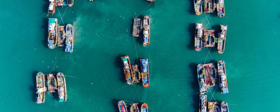
The next time you cook a fish or order some seafood at a restaurant, think about the image above.
It’s a snapshot of all the fishing happening on the ocean over a six-month period. If you zoomed in, you’d see thousands of blue dots, each showing one instance of likely fishing activity at one point in time. This image captures almost 20 million hours of commercial fishing by tens of thousands of vessels around the world. As we approach World Oceans Day this week, it’s sobering to reflect on the fact that industrial fishing now occurs in more than 55% of the ocean – an area more than four times bigger than all the land used for farming.
The vast majority of fishing vessels follow the rules governing fishing – but many are not, and these bad actors can cause a lot of damage.
Vessels may take too many fish – overfishing – which is causing our fisheries to collapse. Then there is the problem of illegal fishing, which can occur in protected areas, in another country’s waters or on the high seas. Many countries simply don’t have the capacity to enforce fishery management rules. As a result, illegal fishing has become a multi-billion-dollar industry, worth up to $23bn each year. Because of overfishing – both legal and illegal – one third of fisheries assessed in a study by the UN Food and Agriculture Organisation were overfished and over half were fully fished. This threatens jobs and food security for millions of people, all around the world.
The trouble is, so much of this illegal activity is hidden – it happens out to sea, making it difficult to scrutinise what individual vessels are getting up to. To address the problems facing our oceans, we need to know what’s happening beyond the horizon.
Fortunately, we are now beginning to see what happens after commercial fishing vessels leave port. The data that underpins the map above is helping to make fishing activity at sea more transparent. In September 2016, my colleagues and I at Oceana – an advocacy organisation focused on ocean conservation – launched a mapping platform called Global Fishing Watch, along with Google and SkyTruth, a non-profit that uses satellite data to encourage environmental protection.
The interactive map we created allows anyone in the world with an internet connection to see the activities of the commercial fishing fleet globally, in near real-time, for free. Since then, Oceana and others have been using this data to spotlight suspicious activities at sea.
Broadcast signals
The reason we can see these ships is that most large vessels use a tool called the Automatic Identification System, or AIS, to broadcast their location via satellites, so that other vessels can track them and avoid collisions.
We can use that data to see the paths of more than 70,000 fishing vessels. Then we run them all through the Global Fishing Watch algorithm, and use machine learning and cloud computing to identify when they are fishing. The resulting “heat map” then shows us where the fishing is likely happening.
For example, we can see the extent of fishing by national fishing fleets. Let’s just look at three examples.
In the image above, you can see the Chilean fleet (green) fishing off the Chilean Coast and in the South Atlantic Ocean, and the Chinese fleet (orange) fishing far from home, and the Japanese fleet – also fishing far from Japan.
These countries are just examples, but when you put all the countries together, you can get a sense of the magnitude of fishing on our oceans.
The red areas you see on the map are called “no-take” marine protected areas. No commercial fishing is allowed in these areas, but often there is little enforcement. In the image below, you can see the track of one fishing vessel (pink) enter the area.

The large red square in the middle is a World Heritage Site called the Phoenix Islands Protected Area.
The island nation of Kiribati, which governs the area, outlawed fishing on January 1, 2015. But a few months later, Global Fishing Watch was able to reveal illegal fishing within the protected area.
This technology helped the small nation of Kiribati extract a $2 million fine for illegal fishing from the fishing company. This is a lot of money for Kiribati – about 1% of the country’s gross domestic product.
‘Switching off the lights’
But with such hefty fines at stake, why don’t rogue vessels simply switch off their AIS tracking? For starters, many countries require it for vessels of a certain size. Also if they do switch off AIS, they jeopardise the safety of their vessel and crew, putting them at a higher risk of colliding with another vessel – especially at night.
This behaviour in itself may also indicate that a vessel is intentionally avoiding detection to hide suspicious or illegal fishing activities, such as fishing in protected areas, transferring illegally caught fish to another vessel, entering a country’s waters without authorisation or violating other fisheries laws. It would certainly warrant further investigation.
Sometimes we can spot it happening, as captured in the video clip above, which shows a case in the Galapagos – it’s like the lights go out. We will see a track line and then it may disappear for days (around 6-7 seconds in the clip), before reappearing to return to port. In this case it seemed to disappear for 15 days either side of the Galapagos Marine Reserve, where no commercial fishing is allowed.
Transshipping
Another activity that we can now keep a closer eye on with the help of Global Fishing Watch is called “transshipping”.
With transshipping, vessels can transfer their fish catch to another boat, called a refrigerated cargo vessel, and refuel at sea to avoid having to go into port.
While transshipping can be authorised, there are also places where it is not allowed. Transshipping allows vessels to stay at sea for many months at a time. In fact, we have found some vessels that did not touch land for more than a year. (To see transshipping on the Global Fishing Watch interactive, select the ‘vessel encounters’ layer.)
Transshipping allows them to not only stay on the water longer, and fish further from home, but also to avoid the scrutiny that might await them in port.
They may avoid reporting their catch because they overfished or illegally fished. Or they may be hiding human rights abuses, like trapped workers who wish to leave, which unfortunately does occur.
According to the US State Department, “few environments are more conducive to exploitation than the high seas”. Even children are trafficked to work in the fishing industry; as many as 40% of workers in some cases are under 18.
And the most disturbing statistic comes from a UN report, which found that six out of 10 migrantworkers on Thai fishing boats who were surveyed reported seeing a co-worker killed. The majority reported enduring beatings or abuse of some sort.
Governments can play a role in transparency on our oceans, too, by publishing their private vessel tracking data (called vessel monitoring system data) to provide a more complete picture of fishing activities at sea. Indonesia made a big step in transparency when the government published its vessel tracking data in Global Fishing Watch, seen here in green, which filled in a lot more fishing activity in that region of the world. We’re working with the Peruvian government to do the same. With more data, we all get a more complete view of fishing activities worldwide.
So, while there still remains some mystery about what happens on many of the ships that bring you your seafood – we are gradually getting a fuller picture.